November 17, 2012
Distance: 7.2 miles
Time: 3:41 hours
Map:
South
Taconic Trails or
Mount
Everett State Reservation
Parking: Large lot at Mount Washington State Forest Headquarters, at the intersection of East Street and West Street in Mount Washington Township, MA
Restrooms:
Portapotty in parking lot
Post Hike Dinner: Taqueria Azteca, 284 Main Street, Greater Barrington, MA. Take out restaurant. A hole in the wall, but not cheap. Vegetarian/vegan options clearly marked.
Directions:
Trailhead is at parking lot at the park headquarters.
Hike on the blue blazed Alander Mountain Trail.
Pass three side trails - trails are very well marked, with trail names at intersections.
Pass a small cabin on left.
Immediately after the cabin, you come to the intersection of the South Taconic Trail.
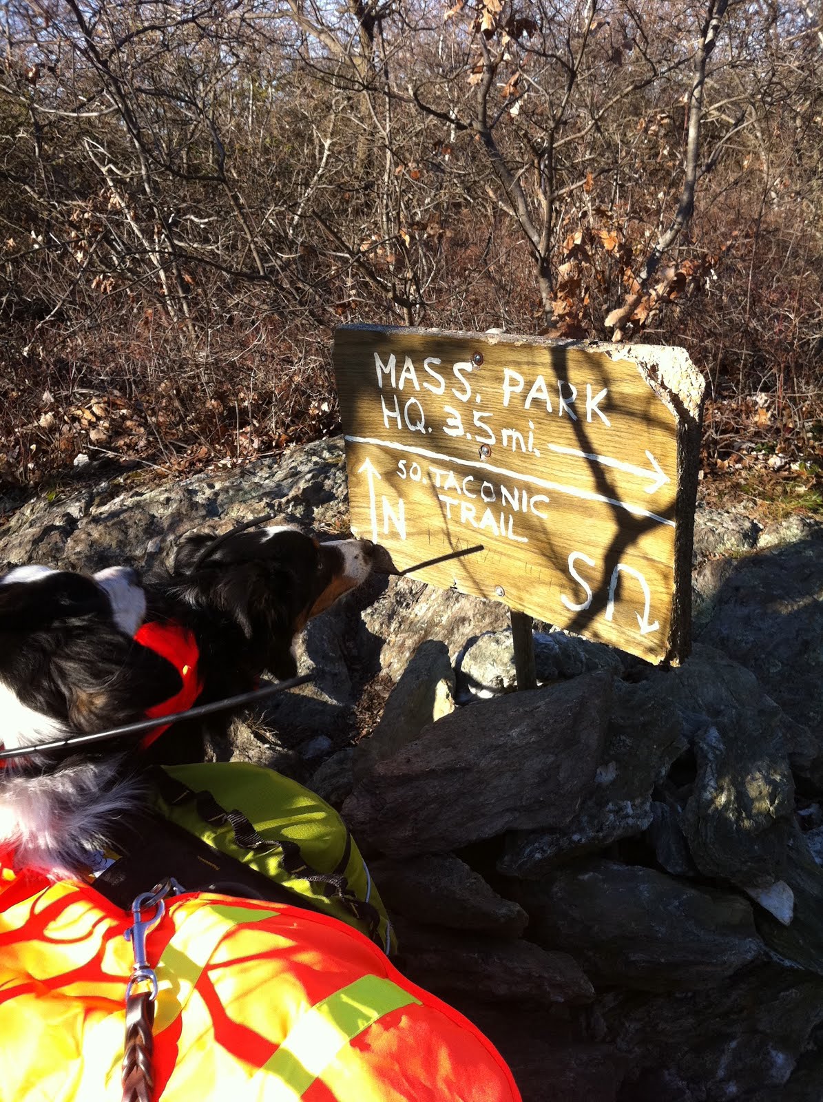
The NYNJTC map shows the summit of Alander Mountain as a left onto the Taconic Trail.
The signs on the trail show the summit of Alander Mountain as a right onto the Taconic Trail.
I'm confused! We did see a summit marker on the trail, so I assume we hit it!
My GPS also matched the signs.
This is an out and back. The beginning and end of the hike are very easy. The trail is wide & pretty level. The trail climbs near the summit, but it is not a difficult hike. Easy/moderate. It is relatively little effort for nice views.
This park allows hunting in season.
Year to date miles: 361
 |
| Our dogs were the only leashed dogs we saw. Decided to keep them leashed due to bow hunting season. |
 |
| Follow the Alander Mountain Trail, almost to the summit. |
 |
| We went across 2 very newly constructed bridges. |
 |
| Intersections with other trails were very clearly marked. |
 |
| Continue on Alander Mountain Trail |
 |
| We crossed this stream again. On the way back, we let the dogs play here. |
 |
| The first 2 miles or so are very easy. The trail is relatively level, and wide. |
 |
Glen decides to put on his orange jacket. We heard shotguns. Bowhunting season in MA, and shotgun season in NY.
We were in MA, but heard shotguns in NY presumably. |
 |
| Looking back at a small cabin that is used by campers. This is where you make a turn to the right (in this photo, it would be to the left). |
 |
| Sign showing the turn right (not left) to the summit. |
 |
| The first time I've seen a sign with a U turn! |
 |
| Starting to get views. |
 |
| We decided to let the dogs loose near the summit. |
 |
| Continue past the summit to get more views! |
 |
| At the MA/NY border (the last hump on ridge we walked along). We decided to turn around here. |
 |
| Looking back at Alander Mountain summit. You'll see a crowd of people there. We came across 2 different scout troops. They loved our dogs. |
 |
| Moxie found some ice & offered it to us. |
 |
| Please throw something for us! |
 |
| Survey marker at the summit. |
 |
Summit marker from 1938, very close to the survey marker. The summit appears like it used to have a fire tower on it.
There were 4 concrete pillars on the summit. |
 |
| Alander summit |
 |
| Alander summit |
 |
| Temperature in the upper 30's, but apparently not too cold to play. |


Great write up, this was helpful. I am planning to hike this trail soon. Did you take the Alander mtn trail back down as well? The only information I can find is from others that did a loop either through the South Taconic or other trails. I just wanted to hike up and back down the same trail. Was the descent very difficult? Glad to know the trail is well marked. Were there any parts of the trail that were very confusing or not very clear? Thanks!
ReplyDelete